top of page

PC134701

PC134702

PC134713

PC134701
1/20
Lucky Day Gold
20.66 Acres
Unpatented Lode Claim
AZ# 105291882
Maricopa County, Arizona
Sale Price: 6,500 USD
Primary Metals
Silver & Copper
Secondary Metals
Gold
Purchase the Lucky Day Gold Lode Claim Outright For 6,500 USD.
Or
Option (1)
Finance in house with 2,600 USD down and a monthly payment of 179.52 USD for 24 months.
Option (2) No Interest!
Fiance in house with 3,250 USD down and a monthly payment of 541.66 USD for 6 months
Claim Features
Surface Workings
Mineralized Ore Piles
Diverse Metals Onsite
Claim Status
Active
Overview
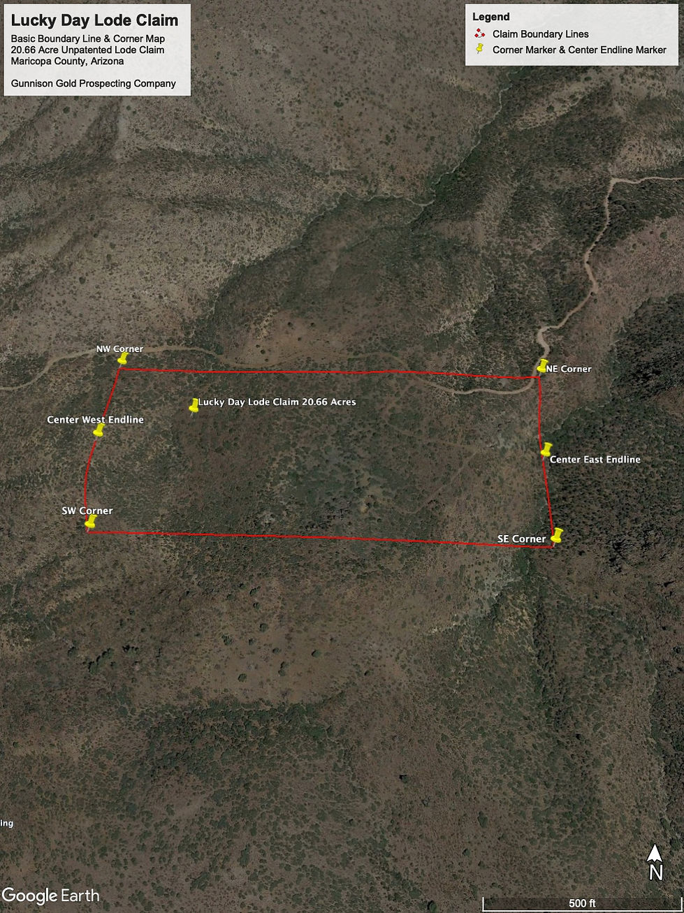
The Lucky Day Gold Claim is a 20.66 acre unpatented Lode Claim located in Maricopa County, Arizona.
Featuring a diverse range of minerals from Silver and Copper to Gold as well.
The Lucky Day Gold Lode Claim consists of two portals one portal is collapsed at the surface and the main portal is still open minus some air slacked rock around the entrance. Of the two portals on the claim the main portal was following a vein of silver primarily while the secondary portal and underground workings was following a vein of Gold & Copper primarily.
With having Silver, Copper, and Gold on the claim, this gives the end claim owner a diversity of minerals to mine and also helps to make metal recovery potentially cheaper on a cost per ton basis due to the additional revenue derived from metals recovered other than gold.
This claim is perfect for a recreational miner to small mining company wanting a deposit that carries more than just gold values and wants a claim with numerous portals and underground workings on the claim.
Geological Trends & Structures
The primary vein system was traced for 905' on the surface on a compass heading of 62.07˚ with a NE/SW trend. Small stock works of additional mineralization was located in three different areas on a general N/S trend against the main vein structure.
Consequently where the three separate vein structures connect with the main vein structure that is where to main previous workings were on the claim and held the best looking ore body both still in-situ within the old workings and even quality rock within the tailings piles surrounding the old works.
Water
The Quien Sabe Spring is located 1,104' on a compass heading of 219.44˚from the South Center of the claim
Camping
Camping is allowed on the claim for up to 14 days at a time without a permit
Access
Access to the claim is via dirt Forest Service Roads and can be traveled with standard 4WD pickup truck of ATV. There are two ways to access to claim, from the West via Trail 246 or from the East at Bronco Creek Crossing on Trail 247.
Commodities
Silver
Importance
Primary
Copper
Importance
Primary
Gold
Importance
Secondary
Ore Body
Early Proterozoic Metavolcanic Rocks


bottom of page
